


Ecosystem Restoration Needs Evidence of Recovery as Well as Activity
Ecosystem restoration needs evidence about what happens after work begins. Planting, clearing an obstruction or funding a project records an activity; monitoring helps explain the resulting condition of the site. For Trinidad and Tobago, Guyana, Suriname and the wider Caribbean, a useful programme connects ecological observations with relevant environmental measurements and a clear management purpose.
Imagine a project team returning to a wetland after a successful planting event. It has photographs, attendance records and a count of seedlings installed. However, those records do not yet explain survival, changing site conditions or progress towards the project's ecological objectives. The next stage requires a different kind of evidence.
The latest global restoration assessment makes this distinction timely. At the same time, recent regional information initiatives show the value of keeping observations accessible and connected. A project can apply that principle from its first baseline visit.
What the new ecosystem restoration report tells us
Published on 29 October 2026, the Restoration Progress Report brings together work by FAO, UNEP and the Convention on Biological Diversity Secretariat. It documents about 252 million hectares under restoration across 149 countries. It also identifies uneven progress and important monitoring gaps, particularly for freshwater, marine and coastal ecosystems.
The phrase under restoration describes ongoing efforts. It should not become a claim that every documented hectare has reached a fully recovered condition. Therefore, a local project should distinguish its intervention area from evidence of ecological outcomes.
Put global figures in their proper role
An international assessment provides context for the importance of restoration and monitoring. A regional site still needs its own objectives, baseline and review process. The global total cannot establish whether one wetland or coastal project is progressing as intended.
Similarly, a national commitment and a completed field activity answer different questions. Keep the reporting level clear. This helps readers understand whether they are reviewing a policy ambition, programme coverage or measured change at a particular location.
Define the ecosystem restoration objective first
A monitoring programme should begin with what the project intends to improve. An objective involving habitat condition may need different observations from one focused on a specific pressure. The project team should agree that purpose before selecting a list of tests.
For example, improving a site's ecological condition is a broader objective than completing a planting schedule. The monitoring brief should identify which observations would help assess progress. Otherwise, the team may collect convenient information that does not answer its main question.
Make the objective understandable
Describe the intended direction of change in language that project staff, funders and local participants can follow. Then identify how the technical team will evaluate it. This connects a public project description with the practical monitoring work.
Avoid promising a fixed outcome before investigating the site. The baseline may reveal constraints that require a revised approach. A clear objective should guide learning without preventing the team from responding to new evidence.
A baseline gives ecosystem restoration a starting point
Record the site's condition before the relevant intervention where possible. The baseline should identify its date, locations, methods and known limitations. In addition, preserve the context needed to interpret later observations.
If work has already started, explain that fact. An early monitoring visit can still provide useful information, but it is not automatically a pre-intervention baseline. Honest timing prevents a later report from giving the comparison more strength than it has.
Bring existing information together carefully
Previous surveys, maps and community observations may help describe the site's history. Check their dates, boundaries and purpose before combining them. Two records bearing the same place name may cover different areas or conditions.
For example, an old aerial image can help explain location and landscape context. It does not establish current water quality or today's ecological condition. Retain the original date and describe what the material can reasonably contribute.
Choose indicators that fit ecosystem restoration
An indicator should connect with the objective and the condition being assessed. The project may need ecological observations, physical information or selected chemical analyses. The appropriate combination depends on the site and the question.
Keep the list proportionate to the decision. More parameters do not automatically create a more useful programme. A smaller, well-designed set of observations can be easier to maintain and interpret than a broad list without a clear purpose.
Keep activity measures and condition measures separate
Record the area treated, work completed and materials installed as implementation information. Separately, describe the observations used to assess site condition. This allows management to see both delivery and progress without treating them as interchangeable.
For instance, a planting count can confirm an important project milestone. A later survival survey asks another question. Neither record needs to replace the other; each should retain its identity and role.
Name the basis of each conclusion
A statement about vegetation, water or sediment should identify the evidence behind it. A photograph supports a visual observation, while an analytical report describes its specific sample and scope. The final interpretation should connect these records explicitly.
If the evidence remains incomplete, state the open question. The team can then decide whether additional work would change the management response. This gives uncertainty a practical place in the project plan.
Water and sediment in ecosystem restoration monitoring
Water and sediment investigations can support a defined restoration question. However, they need appropriate locations, timing and analytical scope. A sample collected at a convenient access point may not represent the area or process that concerns the project team.
First, explain why the material is being sampled. Next, identify how the results will relate to the ecological observations. This prevents a laboratory programme from becoming a detached set of numbers alongside a separate habitat report.
Do not turn one sample into a site-wide verdict
A result describes the material collected under a specified design. It should not automatically characterise an entire wetland or coastal area. The interpretation needs to reflect the coverage achieved and the method's limitations.
Similarly, a favourable result for one parameter does not establish that every restoration objective has been met. The report should state which question the analysis addresses. A clear scope preserves the usefulness of the finding.
Timing matters to ecosystem restoration evidence
Plan repeat visits around the conditions relevant to the project. Rainfall, tides and seasonal activity can affect how observations should be compared. The technical team should explain which factors matter at the specific site.
A difference between two visits does not automatically reveal the effect of the intervention. Review the timing and surrounding conditions before assigning a cause. This is especially useful when the monitoring period is short or the site is naturally variable.
Keep a field context record
Record relevant weather, access conditions, water state and activity during the visit. Use consistent location names and identifiers. These details can make the difference between an interpretable comparison and a puzzling spreadsheet.
If the team could not reach a planned position, document the gap and any replacement location. Do not silently treat a different point as an exact repeat. The limitation may be manageable, but a reviewer needs to know it exists.
Design comparisons that support the question
A project may compare observations over time, between locations or against a suitable reference. Each approach needs an explicit purpose. The technical team should consider what the comparison can show and what other explanations remain possible.
For example, a nearby location may differ from the intervention area in important ways. Calling it a reference does not remove those differences. Describe its role and the basis for using it before presenting a strong outcome claim.
Preserve the method when the team changes
Restoration projects can continue beyond one contract or funding period. Keep field instructions, location information and reporting definitions available to the next team. Otherwise, a change in staff may create an avoidable break in the record.
Where a method changes, explain when and why. The improvement may be worthwhile, but the old and new observations may need careful interpretation. A transparent method history supports a more useful long-term dataset.
Photographs and maps in ecosystem restoration
Images can make site information easier to understand. For repeat photographs, record the position, direction and date where appropriate. This helps the team recognise whether a visible difference reflects site change or simply a different viewpoint.
Maps should identify boundaries and distinguish the area surveyed from the area under intervention. In addition, retain the date and source of supporting layers. A visually clear map should also carry a clear explanation of what it represents.
Avoid using illustration as proof
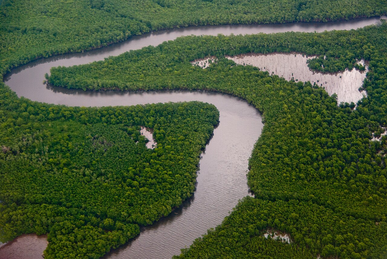
The historic Caroni Swamp photograph accompanying this article illustrates a Trinidad wetland. It does not document a current restoration project or establish present conditions. That distinction applies equally to images used in a company's own reporting.
Choose captions and source notes that preserve dates and context. A compelling image should help readers understand the work. It should not carry an outcome claim that the monitoring record cannot support.
Guyana's new mangrove information example
Guyana's Department of Public Information reported the relaunch of the Guyana Mangrove Information System on 28 October 2026. Developed by NAREI with GGGI support, GuyMIS brings together maps, project information and research resources. The government describes its role in supporting monitoring and coastal protection planning.
This provides a concrete regional example of connecting environmental information. It does not establish the success of every project represented in the system. Site-level conclusions still require appropriate observations and interpretation.
Connect the project record with the wider picture
A local team can learn from the principle of consistent, accessible information. Its field records should identify the project, location and date clearly enough to relate to a wider overview. That makes collaboration easier without erasing the detail of individual observations.
For example, a project map and a laboratory report can share a location identifier. A reviewer can then see where the sample fits in the landscape. This is a practical information-management choice that strengthens later review.
Suriname's ecosystem restoration coordination context
SBB's coastal nature-project overview describes an information-sharing effort informed by workshops in October 2025 and April 2026. The overview, last updated in April 2026, brings together project and monitoring information. It explicitly notes that the listing is not exhaustive.
The update date matters. A project entry should not automatically become a claim about its status in November. Readers planning a collaboration should confirm the current scope with the responsible organisation.
Distinguish a project listing from measured recovery
A list can reveal who is working on related questions and where coordination may help. It does not replace the observations needed to assess a site's condition. Keep that distinction clear when using regional information in a business or project proposal.
For a hypothetical Suriname monitoring assignment, the first discussion could identify the existing studies and remaining questions. The team can then avoid unnecessary duplication while addressing gaps. This is a planning example, rather than a report on a named restoration outcome.
Ecosystem restoration planning in Trinidad and Tobago
A hypothetical Trinidad wetland project might begin by bringing together site history, current ecological observations and a map of the proposed intervention. The baseline brief can identify the environmental measurements needed to answer particular questions. Each element should have a defined role.
A Tobago coastal project may need a different survey arrangement reflecting its actual location and objectives. The regional setting does not justify copying a sampling plan unchanged. Site conditions should guide the methods and the interpretation.
Define the ECOTOX contribution early
ECOTOX lists environmental baseline surveys and marine, terrestrial and wetlands ecological surveys among its consultancy services. Its sampling services also cover water, marine sediment, soils and related materials. These capabilities provide a relevant starting point for a project discussion.
The proposed scope should identify the ecosystem, intended decisions and available information. Confirm the specialist methods and interpretation required for the assignment. This helps the project connect field observations, laboratory work and ecological questions from the outset.
Wider Caribbean programmes need local detail
A regional programme can use common reporting definitions while allowing different sites to use suitable indicators. Consistency should make information understandable, rather than force every ecosystem into the same test list. State which measures can reasonably be compared.
For example, two projects may both report an intervention area but pursue different ecological objectives. Their progress needs context beyond the headline area. The regional summary should retain those distinctions when describing programme outcomes.
Give communities a clear role
Local participants can contribute observations and knowledge about changes at a site. Agree how the team will record, check and use that information. The process should respect participants and explain the purpose of the monitoring work.
If volunteers collect observations, provide suitable instructions and support. Also identify which tasks require specialist field or laboratory methods. Different contributors can strengthen a programme when their roles and evidence remain clear.
Use ecosystem restoration findings to guide action
Monitoring should connect with a management review. Identify who receives the results and which findings would prompt further investigation or an adjustment. Otherwise, a careful survey may end in a report that nobody uses.
A project could discover that an original assumption needs review. The useful response is to examine the evidence and decide the next step. An adjustment can show responsible management rather than failure, provided the reasoning remains documented.
Review the cause before changing the intervention
An unexpected observation may have several possible explanations. The team should consider the available context before selecting a response. Additional fieldwork may be more useful than immediately repeating the original activity.
Record what the review concluded and what remains uncertain. Next, assign responsibility for the follow-up. This creates a connection between monitoring, decisions and the next round of work.
Keep restoration claims within the evidence
A company can report work completed, resources committed and observations collected. It can separately describe measured changes when the record supports them. The wording should identify the period, boundary and basis of the claim.
Avoid turning a short-term observation into a promise of permanent recovery. Similarly, a restored-area figure should not automatically become a carbon-credit claim. Specialist requirements and verification would need separate consideration for that purpose.
A useful progress statement
A clear statement could explain that the team completed a defined intervention and began repeat monitoring at identified locations. It could then summarise the observations available so far. Any conclusion about recovery should remain proportionate to that evidence.
This approach gives funders and participants a more informative account. They can distinguish delivery from ecological progress and understand what the next review will assess. Precise reporting also makes later improvements easier to demonstrate.
What FERM contributes to ecosystem restoration
FAO describes the Framework for Ecosystem Restoration Monitoring, or FERM, as the official monitoring platform for the UN Decade on Ecosystem Restoration. It brings together geospatial information, a registry and access to methods and good practices. Its wider role is to support transparent monitoring and reporting.
A project can use such resources to understand the reporting context. However, participating in an information platform is different from establishing every site-level outcome. The field programme still needs a suitable design and clear interpretation.
A practical brief for the next monitoring phase
Bring together the project boundary, objectives, existing records and work already completed. Identify the next decision and when it needs to be made. The technical team can then determine which observations would best support it.
Also discuss access, repeat visits, data ownership and reporting responsibilities. These practical arrangements affect whether monitoring can continue consistently. Planning them early can prevent a useful baseline from becoming an isolated document.
How ECOTOX can support ecosystem restoration evidence
Explore ECOTOX consultancy and speciality services and specialised sampling services to discuss the appropriate contribution. Explain the site, ecological objective, proposed intervention and environmental questions. The assignment can then connect suitable services with the project's actual decisions.
For organisations in Trinidad and Tobago, Guyana, Suriname and the wider Caribbean, ecosystem restoration offers more value when progress remains reviewable. A clear baseline, purposeful monitoring and honest interpretation help the team learn what is changing and decide what to do next.
Sources
- UNEP announcement of the UN Restoration Progress Report. 29 October 2026.
- FAO restoration monitoring update on area indicators and recovery outcomes. 21 July 2026.
- FAO Framework for Ecosystem Restoration Monitoring. Accessed 20 November 2026.
- ECOTOX consultancy services. Accessed 20 November 2026.
- UNEP, FAO and CBD Restoration Progress Report (29 October 2026). Accessed 20 November 2026.
- Guyana Government GuyMIS update (28 October 2026). Accessed 20 November 2026.
- Suriname SBB coastal nature-project overview, updated April 2026. Accessed 20 November 2026.
Image credit: Bas Leenders. Caroni Swamp Trinidad. CC BY-SA 2.0. Historic aerial photograph from January 2009, used to illustrate a Trinidad wetland. It does not document a restoration project or current conditions. Wikimedia supplied a reduced resolution copy; no other edits. The image retains its CC BY-SA 2.0 licence.
