


Antarctic Ice Loss and Sea-Level Rise: What New Research Means for Caribbean Coastlines
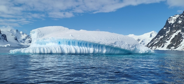
Antarctica is very likely to continue losing ice this century, even if the world makes substantial reductions in greenhouse gas emissions. However, the amount of ice lost still depends on future emissions.
That is the central finding of new research published on September 30, 2026, in Nature Geoscience.
An international team of scientists, including researchers affiliated with Rutgers University, developed an advanced modelling approach to investigate how the Antarctic Ice Sheet may respond to different emissions pathways through 2100.
The study found at least a 92% modelled probability that Antarctica will experience net ice loss this century even under an ambitious emissions-reduction scenario.
However, the researchers also found at least an 89% probability that a very low-emissions pathway would produce less Antarctic ice loss by 2100 than a very high-emissions pathway.
These results carry important implications for global sea-level rise, climate adaptation and coastal infrastructure planning.
For Trinidad and Tobago and the wider Caribbean, the study reinforces an important principle:
Long-term coastal planning must account for sea-level rise, while recognising that future emissions decisions can still influence the magnitude of that risk.
Why does Antarctic ice loss matter?
Antarctica contains the largest reservoir of frozen freshwater on Earth.
Much of that ice is stored in a continental ice sheet resting on land.
When land-based ice moves into the ocean and is lost through melting or iceberg discharge, it contributes additional water to the oceans and raises global mean sea level.
If the Antarctic Ice Sheet were to disappear completely, the total quantity of ice stored there would be equivalent to approximately 58 metres of global mean sea-level rise.
This is a description of the ice sheet’s total potential contribution, not a prediction that such a loss will occur this century.
The more immediate concern is how the ice sheet responds to warming during the coming decades and centuries.
Even comparatively modest changes in sea level can influence flooding exposure, coastal erosion and the performance of infrastructure.
These effects depend on the location and characteristics of each coastline.
How does Antarctic ice reach the ocean?
Understanding the difference between grounded ice and floating ice shelves is essential to interpreting the research.
Grounded ice
Much of Antarctica’s ice rests on the underlying continent.
Gravity gradually causes ice to move toward the coast through glaciers and large ice streams.
When land-based ice is transferred into the ocean and subsequently lost, it contributes to sea-level rise.
Floating ice shelves
At parts of the Antarctic coastline, glaciers extend beyond the point where they leave the bedrock and begin floating.
These floating extensions are known as ice shelves.
Because ice shelves already displace ocean water, their direct melting has a much smaller sea-level effect than the loss of grounded ice.
However, ice shelves perform an important mechanical function.
They help restrain the flow of glaciers behind them, an effect known as buttressing.
When ocean water melts ice shelves from below, they may become thinner and less able to restrain upstream glaciers.
This can allow grounded ice to move more quickly into the ocean.
Consequently, the loss of a floating ice shelf can indirectly accelerate global sea-level rise.
Ice movement over bedrock
The rate at which glaciers move also depends on conditions at their base.
Ice may deform internally, slide along the underlying bedrock or interact with water beneath the ice sheet.
These processes affect how quickly grounded ice reaches the ocean.
They are also among the most difficult physical behaviours to represent accurately in computer models.
What did the new research investigate?
The study was titled Committed Antarctic Ice Sheet mass loss by the end of the twenty-first century.
Its authors included Yucheng Lin, Xuebin Zhang, Nicholas R. Golledge, Robert E. Kopp, John A. Church, Yi Jin, Chen Zhao and Chris R. Stokes.
The research investigated how uncertainty in different parts of the climate-modelling process affects projections of Antarctic ice loss.
The researchers considered several interconnected questions.
First, how do future greenhouse gas emissions influence the atmospheric and ocean conditions surrounding Antarctica?
Second, how do warming oceans affect the melting of floating ice shelves?
Third, how do alternative representations of glacier movement change projections of ice flowing into the ocean?
Finally, can satellite observations help identify which modelling assumptions are more consistent with Antarctica’s observed behaviour?
The objective was not to predict one guaranteed outcome.
It was to improve understanding of the range of possible outcomes and the physical assumptions responsible for uncertainty.
How did researchers use machine learning?
Detailed Antarctic ice-sheet simulations require substantial computing resources.
Each simulation must account for interactions among climate conditions, ocean temperatures, ice-shelf behaviour and glacier movement.
Running every possible combination of assumptions directly would be computationally expensive.
The researchers therefore developed a machine-learning emulation framework.
An emulator is a computational system trained to approximate the relationships represented by more detailed models.
In this study, the emulator was trained using simulations from an existing international ice-sheet modelling ensemble.
It learned how different model assumptions affected projected ice loss and sea-level contributions.
This allowed the researchers to evaluate many alternative combinations more efficiently than would have been possible through repeated full ice-sheet simulations.
Machine learning was used to analyse and approximate existing physical simulations. It did not replace the underlying physics with direct observations of future climate conditions.
The quality and coverage of the original simulations remain important limitations.
How were the projections checked against observations?
An important strength of the study was its use of satellite observations.
The researchers compared modelled Antarctic ice-loss behaviour with observations covering 2002–2021.
They used a statistical approach known as Bayesian calibration to give greater weight to combinations of modelling assumptions that were more consistent with the observed changes.
This helped constrain the range of projected outcomes.
The method also allowed researchers to investigate which assumptions contributed most strongly to uncertainty.
However, matching observations over a historical period does not guarantee that a model captures every physical mechanism that may become important in the future.
The study therefore remains a model-based assessment with uncertainty, rather than a direct measurement of what Antarctica will do in 2100.
What were the main findings?
1. Antarctic ice loss is very likely even with ambitious emissions reductions
The researchers examined several future emissions pathways, including a very low-emissions scenario designated SSP1-1.9.
This pathway is consistent with highly ambitious global emissions reductions associated with the objectives of the Paris Agreement.
Even under that scenario, the study estimated at least a 92% probability of net Antarctic ice-sheet mass loss during the twenty-first century.
This finding suggests that continued Antarctic ice loss is already strongly indicated by the climate system’s response to past and future conditions.
It does not mean every Antarctic glacier must lose ice at the same rate or that the entire ice sheet will disappear.
It also does not mean emissions reductions are ineffective.
2. Cutting emissions still makes a meaningful difference
The researchers found at least an 89% probability that the very low-emissions scenario would produce less Antarctic mass loss by 2100 than a very high-emissions pathway.
This is a critical distinction.
The study indicates that the future behaviour of the Antarctic Ice Sheet is not completely independent of decisions about greenhouse gas emissions.
Reducing emissions can limit the warming of the ocean and atmosphere that drives ice loss.
The amount of warming avoided can influence whether certain combinations of ice-sheet changes are triggered.
Thus, continued ice loss and the benefits of emissions reduction are not contradictory findings.
Both can be true.
3. High-end Antarctic sea-level contributions remain possible
Under the very high-emissions SSP5-8.5 pathway, the researchers identified combinations of physical mechanisms that could generate substantial ice loss while remaining consistent with satellite observations.
In a selected high-end analysis, the projected Antarctic contribution to global mean sea level by 2100 had:
- A median estimate of approximately 15.7 centimetres.
- A 95th-percentile estimate of approximately 25.4 centimetres.
These figures are conditional results from the selected high-end modelling framework.
They are not the study’s universal central forecast across all modelling choices.
The 95th-percentile result is also not an absolute physical upper limit.
Outcomes beyond the represented range remain possible, particularly if important processes are absent from the original simulations.
4. Several interacting physical mechanisms drive uncertainty
The researchers identified three particularly important sources of uncertainty.
Ice-shelf melting: Different representations of melting beneath floating ice shelves can produce different projections of ice loss.
Basal sliding: The physical assumptions used to describe ice movement over underlying bedrock strongly influence the movement of glaciers.
Regional ocean and atmospheric warming: Different climate models produce different patterns of warming around Antarctica.
These uncertainties interact rather than operating independently.
For example, warmer ocean water may increase ice-shelf melting, reduce buttressing and alter the speed of grounded ice flow.
Under particular conditions, the processes can reinforce one another.
Understanding these interactions is essential to improving future projections.
Why is Antarctica so difficult to model?
Antarctica covers an enormous area, and its ice sheet contains regions with very different physical characteristics.
Some ice rests on bedrock above sea level.
Other sections occupy deep basins, with grounded ice interacting directly with the ocean along complex margins.
Ocean circulation around Antarctica also varies geographically.
Warm water reaching the underside of an ice shelf may cause substantial melting in one location but have a different effect elsewhere.
Several challenges remain.
Satellite observations provide valuable information about ice-sheet changes, but they do not resolve every process beneath thick ice.
Subglacial water systems can be difficult to observe.
Ice-sheet models also require decisions about spatial resolution, numerical methods, physical parameterisations and how present-day conditions are initialised.
The 2026 researchers demonstrated that these modelling decisions themselves can materially influence projected outcomes.
A model ensemble containing many simulations does not automatically remove this problem if numerous models share similar assumptions.
The study therefore recommends more systematic documentation of model characteristics and better targeted measurements of the processes that contribute most to uncertainty.
What are the main limitations of the study?
The research advances understanding of Antarctic ice-sheet uncertainty, but its conclusions require several qualifications.
Future emissions scenarios are not forecasts
The study compared alternative future pathways.
These scenarios represent possible emissions conditions used to investigate climate responses.
They do not establish which pathway governments, industries or societies will ultimately follow.
The emulator depends on existing simulations
The machine-learning system was trained on a defined collection of ice-sheet models.
It cannot reliably account for physical processes that were absent from that collection.
The authors identified unresolved interactions involving ice, oceans, atmosphere and water beneath the ice sheet.
Observational calibration is not independent verification of the future
The satellite record allows the researchers to test whether simulated historical behaviour resembles observed Antarctic changes.
However, future warming may activate processes not sufficiently represented in the calibration period.
This remains a significant source of uncertainty.
The analysis focuses on the period to 2100
The researchers restricted their principal emulator assessment to 2100 because the available ensemble was insufficient to represent some stronger nonlinear responses that may emerge farther into the future.
The findings should not be extrapolated mechanically to 2200 or 2500.
Antarctic contributions are not total sea-level rise
The estimated contributions exclude several other components of global sea-level change.
These include the Greenland Ice Sheet, mountain glaciers, thermal expansion of seawater and changes in land-water storage.
It would therefore be misleading to present the Antarctic figures as the complete global sea-level-rise projection.
Global results are not automatically local projections
A global mean estimate cannot be applied directly to a particular coastline.
Regional sea level depends on additional physical processes, including ocean circulation, Earth’s gravitational field and vertical land movement.
Local coastal planning requires appropriate regional projections and site-level evidence.
Why does global sea-level rise vary between coastlines?
Sea-level rise is often described as a global average.
However, the change experienced at a particular coast may differ from that average.
Several processes influence regional and local sea level.
Ocean circulation: Currents and variations in ocean temperature and salinity affect how sea level changes geographically.
Gravitational and rotational effects: Large ice masses influence Earth’s gravitational field and rotation. As they lose mass, the resulting sea-level pattern differs around the world.
Vertical land movement: Land subsidence can increase relative sea-level rise, while land uplift can reduce it.
Coastal hydrodynamics: Tides, waves, storm surge and local bathymetry determine how changes in mean sea level translate into extreme water levels.
Human modification of coastlines: Reclamation, drainage systems, coastal structures and changes in sediment supply can influence local flooding and erosion.
These processes explain why a global estimate of Antarctic ice loss should not be interpreted as a site-specific inundation forecast.
For meaningful coastal-risk assessment, regional climate information must be combined with local environmental and engineering data.
What does the research mean for the Caribbean?
The Intergovernmental Panel on Climate Change (IPCC) has identified sea-level rise, coastal flooding and shoreline change as significant issues for small-island environments.
Its Sixth Assessment Report identifies substantial risks to coastal settlements, infrastructure and ecosystems.
For the Caribbean, these concerns are especially relevant where important economic activities and communities are concentrated near the coast.
Ports, industrial facilities, tourism infrastructure, coastal roads and utilities may be exposed to changing coastal conditions.
However, vulnerability differs among locations because of elevation, exposure, coastal geology, protective ecosystems and infrastructure characteristics.
The Rutgers research does not calculate the future water level at any specific Caribbean port, beach or industrial facility.
Instead, it provides further evidence that the global contribution from Antarctica remains sensitive to future emissions pathways.
The practical implication is that coastal adaptation should be informed by credible scenario-based projections and updated environmental evidence.
Implications for Trinidad and Tobago
Trinidad and Tobago has already identified coastal erosion, flooding and climate adaptation as areas requiring active management.
The Ministry of Works and Transport established its Coastal Protection Unit to address shoreline erosion, coastal flooding and related environmental and infrastructure concerns.
The unit implements the Critical Coastal Protection Programme and supports long-term coastline monitoring.
The Ministry has also established a Comprehensive National Coastal Monitoring Programme to improve coastal information and support shoreline-management decisions.
In April 2026, the Ministry of Planning published Trinidad and Tobago’s National Climate Change Policy, setting out the country’s approach to addressing climate-change drivers and impacts.
These initiatives provide a relevant local context for the scientific findings.
Industrial and port infrastructure
Long-lived infrastructure located near the coast may need to account for changes in mean sea level and extreme coastal conditions.
Potential investigation areas include:
- Existing site elevation and drainage arrangements
- Shoreline condition and historical erosion
- Coastal flooding pathways
- Groundwater conditions
- Receiving-water and sediment characteristics
- The condition of nearby wetlands or coastal ecosystems
- Climate-related design considerations
The appropriate investigation depends on the project and its exposure to specific hazards.
Coastal water and groundwater conditions
Rising sea levels may influence saltwater intrusion in certain coastal aquifers and drainage systems.
However, groundwater salinisation depends on local hydrogeology, abstraction patterns, water levels and other factors.
A change in groundwater conductivity or chloride concentration does not automatically establish that global sea-level rise caused it.
Historical data and site-specific investigations are necessary to evaluate possible explanations.
Wetlands and coastal ecosystems
Coastal wetlands can be influenced by changes in water levels, salinity, sediment deposition and inundation frequency.
Some wetlands may adapt through sediment accumulation or landward migration, depending on local circumstances.
Others may face greater pressure where development restricts their ability to respond.
Environmental monitoring can help evaluate changes in relevant water-quality, sediment and ecological parameters.
However, changes in those measurements must be interpreted alongside land use, local hydrology and other environmental influences.
Why environmental baselines matter for climate adaptation
An environmental baseline records conditions against which future observations or potential project impacts can be evaluated.
For coastal developments, the baseline may include physical, chemical and ecological information.
Depending on the investigation, this can involve:
- Marine-water quality
- Coastal sediment characteristics
- Surface-water and stormwater conditions
- Groundwater chemistry
- Wetland environmental conditions
- Environmental contaminants
- Ecological receptors and habitat characteristics
- Relevant meteorological and hydrological information
These measurements can support environmental impact assessment, operational monitoring and regulatory compliance.
However, a baseline established today may not remain representative of every future condition experienced by a facility.
For projects with long operational lifetimes, the assessment should consider whether appropriate regional climate and coastal-risk information is also needed.
Environmental monitoring does not replace specialised sea-level projection or coastal engineering.
Instead, it provides complementary site-specific evidence to support broader planning.
A practical framework for climate-informed coastal environmental assessment
The scientific findings support a structured approach to long-term coastal planning.
Step 1: Define the project and its planning horizon
Identify the expected operational life of the infrastructure or development.
A short-duration investigation may require a different level of climate analysis from a major installation expected to operate for decades.
Step 2: Establish the existing environmental baseline
Collect representative environmental data using appropriate sampling methods.
Document site conditions, sensitive receptors and relevant seasonal variation.
Historical records should be reviewed where available.
Step 3: Identify coastal hazards
Assess whether the location may be affected by shoreline erosion, extreme water levels, drainage constraints, coastal flooding, groundwater salinity or other relevant hazards.
Hazards should be selected based on local evidence rather than assumed to apply equally to every coastal site.
Step 4: Select appropriate sea-level projections
Use suitable regional projections that specify their emissions scenarios, baseline periods, time horizons and uncertainties.
Where relevant, consider more than one plausible future pathway.
A high-end scenario may be useful for testing infrastructure resilience, but it should not be presented as the most probable outcome without supporting analysis.
Step 5: Investigate local conditions
Integrate information about elevation, land movement, coastal processes, hydrology and environmental receptors.
Specialised surveying, coastal modelling or geotechnical assessment may be necessary depending on the project’s objectives.
Step 6: Evaluate potential environmental interactions
Consider whether future coastal changes may affect stormwater management, wastewater infrastructure, material storage, receiving-water quality or sensitive habitats.
These are potential investigation questions, not evidence that a particular facility is already causing environmental harm.
Step 7: Design an adaptive monitoring programme
Where warranted, develop monitoring that can detect meaningful changes over time.
This may include repeating baseline measurements, maintaining appropriate reference locations and reviewing trends against defined decision criteria.
Step 8: Document uncertainty transparently
Distinguish observed environmental conditions from modelled future hazards.
Identify assumptions, analytical limitations, confidence levels and unresolved questions.
This helps ensure that planning decisions are based on defensible evidence.
How Ecotox can support climate-informed coastal investigations
Ecotox Environmental Services Limited provides environmental sampling, analytical testing and consultancy services relevant to coastal and industrial environmental assessments.
Its published capabilities include:
- Marine-water and sediment sampling
- Riverine and stormwater sampling
- Groundwater monitoring and analysis
- Soil and sediment investigations
- Environmental baseline surveys
- Marine, terrestrial and wetland ecological surveys
- Environmental monitoring programme design
- Environmental compliance-related assessment
- Site-specific environmental investigations
These services can contribute to the environmental evidence needed for coastal development, infrastructure planning and ongoing monitoring.
Where a project requires specialised sea-level projection, flood-inundation modelling, coastal hydrodynamic modelling or detailed structural engineering, the required expertise should be established separately.
Ecotox’s contribution may include environmental baseline data, sampling design, analytical testing and interpretation of environmental conditions within a multidisciplinary assessment.
Learn more about Ecotox Consultancy and Speciality Projects.
Conclusion: Coastal planning must address both unavoidable change and avoidable risk
The September 2026 Nature Geoscience study provides evidence that the Antarctic Ice Sheet is very likely to experience net mass loss this century, even under ambitious global emissions reductions.
However, it also demonstrates that the magnitude of Antarctic ice loss remains influenced by future emissions.
This distinction matters.
The research does not suggest that all future sea-level outcomes are inevitable.
Nor does it suggest that lowering emissions can immediately reverse the influence of warming already experienced by the climate system.
For Trinidad and Tobago and the wider Caribbean, the findings strengthen the case for combining emissions reduction with long-term coastal adaptation.
That approach requires suitable regional climate projections, reliable environmental baselines, appropriate engineering assessments and monitoring capable of identifying meaningful changes.
Reducing emissions can limit future Antarctic ice loss. Preparing for the sea-level changes that remain possible requires sound environmental evidence and responsible long-term planning.
Sources
- Lin, Y., Zhang, X., Golledge, N. R., Kopp, R. E., Church, J. A., Jin, Y., Zhao, C., & Stokes, C. R. (2026). Committed Antarctic Ice Sheet mass loss by the end of the twenty-first century. Nature Geoscience. https://doi.org/10.1038/s41561-026-02102-1
- MacPherson, K. (September 30, 2026). How Cutting Emissions May Limit Antarctic Ice Loss and Protect Coastlines. Rutgers University. https://www.rutgers.edu/news/how-cutting-emissions-may-limit-antarctic-ice-loss-and-protect-coastlines
- Intergovernmental Panel on Climate Change. (2021). Climate Change 2021: The Physical Science Basis — Chapter 9: Ocean, Cryosphere and Sea Level Change. https://www.ipcc.ch/report/ar6/wg1/chapter/chapter-9/
- Intergovernmental Panel on Climate Change. (2022). Climate Change 2022: Impacts, Adaptation and Vulnerability — Chapter 15: Small Islands. https://www.ipcc.ch/report/ar6/wg2/chapter/chapter-15/
- Ministry of Works and Transport, Trinidad and Tobago. Coastal Protection Unit — Who We Are. https://www.mowt.gov.tt/Divisions/Coastal-Protection-Unit/Who-We-Are
- Ministry of Works and Transport, Trinidad and Tobago. Comprehensive National Coastal Monitoring Programme — Overview. https://mowt.gov.tt/Divisions/Coastal-Protection-Unit/Comprehensive-National-Coastal-Monitoring-Programm/Overview
- Ministry of Planning, Economic Affairs and Development, Trinidad and Tobago. (April 9, 2026). The National Climate Change Policy of Trinidad and Tobago. https://www.planning.gov.tt/newsite/the-national-climate-change-policy-of-trinidad-tobago/
- Ecotox Environmental Services Limited. Consultancy and Speciality Projects. https://ecotoxes.ani.quest/services/consultancy__speciality/
- Ecotox Environmental Services Limited. Specialized Sampling Services. https://ecotoxes.ani.quest/services/complete_sampling_services/