
Harnessing Open Geodata & AI for Precision Mosquito Control
Researchers at Heidelberg University have developed an advanced GeoAI framework that transforms openly available geodata—like satellite and street view imagery—into high-resolution urban maps pinpointing Aedes aegypti mosquito breeding hotspots
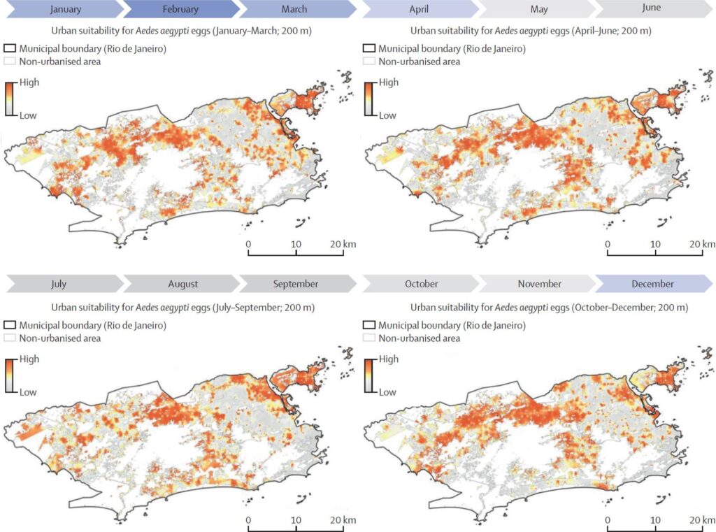
📊 Study Overview
The core innovation uses artificial intelligence and spatio‑temporal modeling to detect breeding site indicators such as water tanks, discarded tires, and plant pots from open geospatial sources. Key inputs include:
- Satellite imagery
- Street-level photos
- Climate and urban‐heat‐island datasets
- Human mobility data (where available)
By combining these with field trap data (egg/larvae counts), researchers achieved a model explaining up to 75% of mosquito abundance variation in Rio de Janeiro.
🚩 Major Findings
- Breeding-site density predicts population hotspots
AI maps container density within 1 km buffers—matching mosquito flight range—yielding spatially continuous predictive maps. - Cost-effective, precise targeting
This approach enables public health teams to focus interventions (e.g., larviciding, source reduction) on high-risk areas, avoiding blanket insecticide use. - Transferability to other cities
Because it relies on openly available data and open-source methods (HeiGIT tools), this framework can be applied in any urban setting facing.
🌍 Ecotox Environmental Services: Elevating Vector Control with Geospatial Intelligence
We help you convert cutting-edge research into actionable mosquito-control strategies:
- GeoAI-driven mapping
Analyze satellite and street view data to detect container density and generate urban suitability maps in your project area. - Field calibration & monitoring
Link remote mapping with ground-truthing—trap counts, larvicide results—to validate hotspot accuracy. - Precision intervention plans
Design spatially targeted measures like larval source management, container removal, or Wolbachia releases—while minimizing ecological impact. - Risk modeling & decision support
Combine geodata with climate and mobility trends to forecast seasonal or event-driven breeding surges and aid resource planning.