


A New Way to Track River Pollution: Flow-Follow Sampling with Drones, Boats & Kayaks
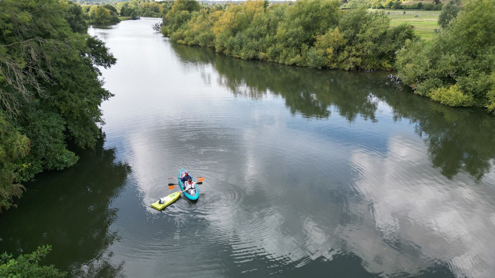
River pollution is notoriously difficult to monitor accurately, especially when multiple pollution sources mix downstream. Scientists at the UK Centre for Ecology & Hydrology (UKCEH), together with the British Geological Survey, are trialing a novel sampling method that more effectively traces how nutrients and pollutants move and mix through river systems. UK Centre for Ecology & Hydrology
What Makes This Approach Different
- Traditional sampling is usually done by collecting water at a single fixed point over time. UK Centre for Ecology & Hydrology
- UKCEH is using Lagrangian sampling, where sampling devices move with the river’s flow to more realistically capture how pollutant concentrations change downstream. UK Centre for Ecology & Hydrology
- To do this, they combine three methods:
- Kayak-based sampling — team members paddle downstream with bottles, gathering water along the path. UK Centre for Ecology & Hydrology
- A remote-controlled “ARC-boat” equipped with water-quality sensors (e.g. sondes) and GPS to map the flow and collect data. UK Centre for Ecology & Hydrology
- Drone thermal imaging — an infrared drone flies over the stretch to capture surface flow patterns that align with sampling points. UK Centre for Ecology & Hydrology
- These data are enriched with isotopic tracers of nutrients, giving insight into where pollution is coming from (e.g. sewage, agricultural runoff) as water travels. UK Centre for Ecology & Hydrology
- They’re analyzing the collected samples for inorganic chemistry and nutrient isotopes at labs (e.g., UKCEH and the National Environmental Isotope Facility). UK Centre for Ecology & Hydrology
Early Results & Next Steps
- During an initial survey of the Thames, the team collected 20 water samples in one pass by kayak, while the ARC-boat followed closely. UK Centre for Ecology & Hydrology
- The drone imagery helped validate where water flow was fastest or mixing zones were forming. UK Centre for Ecology & Hydrology
- Going forward, the team plans to integrate all the data — chemical, isotopic, flow, and thermal — to build a detailed map of how pollutants spread and where they originate. UK Centre for Ecology & Hydrology
- They also plan repeat campaigns in different seasons (e.g. winter or spring) to see how flow regime changes affect pollutant transport. UK Centre for Ecology & Hydrology
Why This Matters for Water Quality Management
- Understanding how and where pollution sources mix is key to creating effective mitigation strategies.
- This method can help regulators, water managers, and communities know which pollution sources (e.g. sewer overflows vs farms) contribute most, and where interventions will make the biggest difference.
- The detailed, high-resolution data will support more accurate modeling of nutrient and pollutant loads, especially during storm or high-flow events.
How Ecotox Environmental Services Can Help
Ecotox already has relevant services that align strongly with this kind of innovative river-pollution work:
- Advanced Sampling Program Design
- Design integrated field studies using Lagrangian sampling, kayak or boat sampling, and remote sensing to trace pollutant movement in rivers.
- Pollutant Fate & Transport Modelling
- Use the data (isotope, flow, concentration) to build models that simulate how pollutants from various sources mix, transform, and travel downstream.
- Isotopic Source Apportionment
- Conduct tracer or isotope-based source attribution analyses to distinguish contributions from sewage, agriculture, or other origins.
- Policy & Remediation Advisory
- Provide guidance on targeted pollution mitigation strategies, drawing from high-resolution data to recommend where interventions will be most effective.